On January 1, 2016, a day that feels like last week and also a lifetime ago, I went on a First Day Hike in Massachusetts. This year, Connecticut had some scheduled First Day Hikes that sounded tempting, but I chose to take the concept of the New Year's Day walk and leave the group tour aspect, and instead go on my own hike at a local spot I hadn't been to in years: Bluff Point State Park and Coastal Reserve in Groton.
Somehow, Bluff Point has escaped this blog until now. But it's a hike (ok, fine, more like a walk) that I'm very fond of. This roughly 3.6-mile loop through what DEEP calls "the last remaining significant piece of undeveloped land along the Connecticut coastline" is a chance to surround yourself with what I think of as three distinct environments. The first is classic Connecticut shoreline, with salt marshes and shell-strewn sand and water that changes colors like a mood ring. The second is an almost desert-like world where trees twist into stunted shapes and leaves stay brown underfoot even when winter has turned other landscapes grey. And the third is an old New England forest, where the rectangular foundation of the farmhouse John Winthrop Jr. (yes, that John Winthrop Jr.) built in 1648 still lurks below ground level, and stone walls run for miles like the complex gates of lost cities, and large boulders stand alone in little clearings, as if the woods wanted to give them space.
At the bluff that forms this protected peninsula's southern tip, the inland forest trail and the flatter coastal road converge. Here, several small, rocky paths branch off from the main route and lead you to a spectacular view. Standing above the Sound, if you face the right direction and ignore the other humans and dogs gathered on the rocks, you can imagine for a moment that you've reached the end of the world. And I guess if the end of the world is as beautiful as Bluff Point, I feel a little bit less afraid about its arrival.
Showing posts with label Groton. Show all posts
Monday, January 2, 2017
Wednesday, July 13, 2016
5 of Connecticut's Best Bridges
EAST HADDAM SWING BRIDGE
I have a bit of a love-hate thing with bridges. Some bridges, I find terrifying (there's no logic to it, but having skyway or spillway or causeway in the name doesn't help.) Other bridges are a pleasure to cross. And then there are the bridges I'd drive a day out of my way to avoid - I mean seriously, who invented this nightmare - but love watching other people traverse on YouTube.
But even though I usually wish I could magically transport my car to the opposite riverbank using the power of my mind, I can't deny the appeal of a bridge. It's not just that they literally take you to places you'd otherwise need a boat to reach, or that they symbolically represent the connection between sometimes very different places. It's also that they often look striking, lending a place an atmosphere it wouldn't otherwise have, and that they're a built-in alert message to bored drivers: Hey, something new and different might waiting for you right over there, on the other side.
I chose these five Connecticut bridges with some very simple criteria: they had to be attractive to look at - as you're crossing them as well as from below; they had to have some interesting facts, trivia, or history associated with them; and they had to lead to a place (or places) worth visiting in its own right. I could have chosen many other bridges with different points to recommend them, such as walkability or age, so if you have a different favorite, do leave a comment below.
East Haddam Swing Bridge (Connecticut River, East Haddam - Haddam)
It's not often that traffic comes to a dead halt at a seemingly random time of day and no one minds because the cause for the hold-up is so darn charming. It pretty much only happens when a line of fuzzy ducklings are crossing the road or when the East Haddam Swing Bridge is swinging. The truss bridge carrying Route 82 across the Connecticut opened to traffic in 1913. Since then, it has pivoted to allow boats to pass, while trapping motorists either in the quiet beauty of Haddam or in East Haddam's intensely picturesque town center.* According to East Haddam's website, which lists the bridge as an attraction, the "899-foot long bridge is reputed to be the longest of its type in the world." And its timing isn't quite random; it "opens to recreational traffic on the hour and half hour and on-demand for commercial barge traffic."
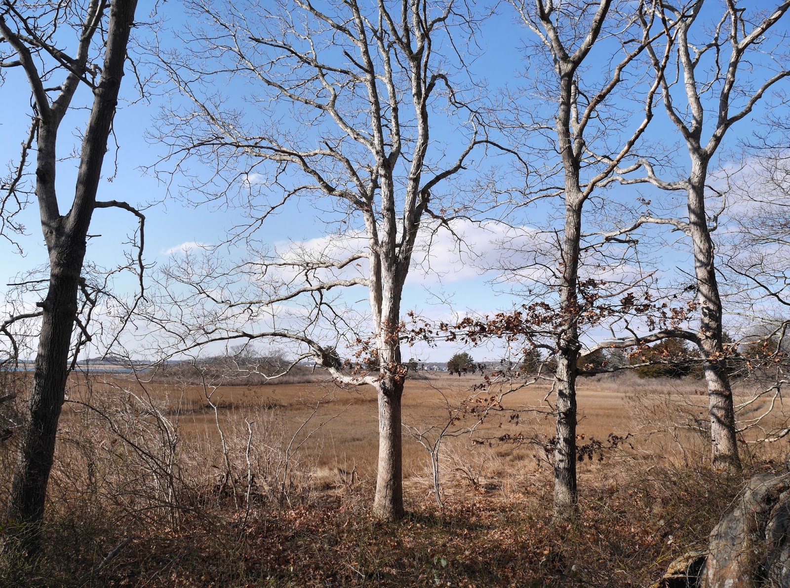
On the Haddam side, you'll find small villages where the distant past feels like just a little while ago and hidden history everywhere you turn. In East Haddam, there's the Goodspeed Opera House (I recently saw my first Goodspeed production and highly recommend the experience), Nathan Hale Schoolhouse, restaurants, independent shops, historic homes, and quite a lot more.
Mystic River Bascule Bridge (Mystic River, Groton - Stonington)
In a town (which is actually not a town) full of tourist destinations, you might think a small drawbridge wouldn't earn the status of a beloved attraction. In Mystic, you'd be mistaken. People come from all over to watch the bascule bridge connecting the Groton and Stonington sides of Mystic go up, letting water traffic pass by and creating a waiting line of vehicles and pedestrians, then go down again. This 1920 bridge carried streetcars in its first few years of use; though those are gone, the bridge retains the look of a curiosity from another age.
There's an ice cream shop perfectly situated for bridge-watching, and downtown Mystic both east and west of the river is usually bustling with people shopping for everything from books to accessories or visiting one of a long list of highly rated restaurants. That's all as nice as it sounds, but as in many parts of Connecticut, the best part might just be wandering the waterfront and its historic neighborhoods. (Make sure to get off of Route 1 and see the side streets.) If you're exploring the area near the bridge itself, I strongly recommend leaving your car and walking; other major highlights like Mystic Seaport and Mystic Aquarium, as well as Olde Mistick Village, are slightly further away.
Route 185 Bridge (Farmington River, Simsbury)
The bridge that carries Route 185, aka Hartford Road, across the Farmington River is officially named the Bataan Corregidor Memorial Bridge, but I've never heard anyone call it that. I've never heard anyone call it anything. It's not grand or long or high. It's not ornate or particularly old (it dates from 1947.) Yet as soon as you spot it, you're instantly struck with a sense of calm and an appreciation for the simplicity of the countryside. This is not one of the scary bridges. And Simsbury is not exactly the countryside - it's a large suburb, and Route 185 is the domain of numerous stressed-out commuters. But the town is a perfect example of how rural and suburban can blend so nicely in Hartford County, and this humble green steel bridge seems to tie it all together.
The main (if not the only) reason people normally visit this bridge on purpose is located in the little park across from Nod Road. It's easy to drive over the bridge multiple times and completely miss this attraction, despite it being very, very big. It's the Pinchot Sycamore, and at 23 feet, 7 inches in circumference, it's Connecticut's largest tree. After you see the tree, cross the bridge to Hopmeadow Street to find Simsbury's historic and bustling downtown. Or head to Rosedale Farms and Vineyards, a favorite of photographers looking for that perfect winery shot. And then, of course, there's the Route 185 Bridge's more famous relative, the gorgeous Old Drake Hill Flower Bridge. Simsbury is a great place to walk, and if you're biking, it might be even better.
West Cornwall Covered Bridge (Housatonic River, Cornwall - Sharon)
Perhaps the most picture-ready of Connecticut's covered bridges, and right up there with those in other New England states too, this barn-red wooden covered lattice truss bridge crosses the Housatonic River in Litchfield County. Though this bridge was built in the late 19th century (and modernized in the 1960s and '70s), a series of earlier bridges have connected the small towns of Cornwall and Sharon (West Cornwall is a part of Cornwall) since sometime in the late 1700s. At 15 feet wide, the bridge can only accommodate one car at a time, so drivers on Route 128 (also called the Sharon-Goshen Turnpike) have to take turns. This works out remarkably well, considering how dangerous it seems when you first encounter the system, and adds to the quaintness of the whole experience.
The area surrounding the bridge is simply beautiful (the phrase "unspoiled by time" may pop into your mind as you drive.) On the Cornwall side, you can still see the building once used as the toll house (which I mentioned in my post about the toll house in Plymouth.) It now houses one of a handful of businesses clustered together on these pleasantly curving roads. Drive the other way, towards the New York border, and you'll reach the center of Sharon,* a classic Connecticut small town laid out so its buildings charmingly line up around the green and continue temptingly down little side-streets.
Arrigoni Bridge (Connecticut River, Portland - Middletown)
The delicate, sky-blue Arrigoni Bridge often comes up in rush-hour traffic reports, but when it's not bothering delayed central Connecticut commuters, it's a lovely landmark that can be appreciated from many vantage points. Completed in 1938, this through arch bridge connects a city known for college students and cupcakes to a town that mostly remains off the tourist radar. Its gently curving steel outline seems to float above Route 17 and Route 66 as they cross the water, and at almost 50 feet wide, it manages to evoke the wide-open sort of river crossing you might expect to find in the Midwest rather than spanning the Connecticut River.
Portland, small in population and not-so-small in area, boasts some architectural surprises (two octagon houses in a row!) and looks like a graceful mix of old river city, comfortably blue collar town, and former industrial center. (The main concern was the brownstone quarries, which provided the raw material for landmark buildings in numerous major East Coast cities.) On the other side of the bridge is Middletown, home of Wesleyan University and numerous cultural institutions. For specifics, click to see why I included Middletown in a previous "Top Five" - 5 Underrated Small Connecticut Cities. From the riverfront near Middletown's broad, welcoming Main Street, you can see traffic crossing the Arrigoni Bridge up above. And you'll also see the bridge if you glance up from Route 9 at that strange moment when it morphs unexpectedly from a highway to a local road complete with traffic lights. This arrangement may be changed eventually, because it is ridiculous, but for now, it's a uniquely weird Connecticut driving experience.
*The town centers of both East Haddam and Sharon are high on my list of places to write proper blog posts about in the future!
Labels:
Cornwall,
East Haddam,
Groton,
Haddam,
Hartford County,
Litchfield County,
Middlesex County,
Middletown,
Mystic,
New London County,
Portland,
Sharon,
Simsbury,
Stonington,
Top Fives
Friday, July 8, 2016
Snapshots From the Connecticut Sub Trail
BILL MEMORIAL LIBRARY, GROTON
If there's any place in the world where the marriage of submarines and public art makes perfect sense, it's southeastern Connecticut. The only thing that's surprising about the CT Sub Trail is that it didn't happen earlier. But as it turns out, the timing is perfect: these 21 roly-poly little subs were created as a part of the celebration of Connecticut's Submarine Century. In the tradition of cows, guitars, apples, and hundreds of other themed objects, the fiberglass subs (designed by local artists and unveiled in Groton on the 4th of July) will be on display around the region through October.
The subs are stationed at schools, museums, and businesses. You can locate them using the CT Sub Trail mobile app. I went looking for a few of them and found a colorful and creative expression of appreciation for Connecticut's history, shoreline, and military and maritime heritage.
BILL MEMORIAL LIBRARY, GROTON
CHILDREN'S MUSEUM OF SOUTHEASTERN CONNECTICUT, NIANTIC
CITY PIER, NEW LONDON
ROUTE 32, UNCASVILLE
COCA-COLA BOTTLING CO. OF SOUTHEASTERN NEW ENGLAND, WATERFORD
LESTERTOWN ROAD, GROTON
WWII NATIONAL SUBMARINE MEMORIAL, GROTON
295 MERIDIAN STREET, GROTON
ELLA T. GRASSO TECHNICAL HIGH SCHOOL, GROTON
BANK SQUARE BOOKS, MYSTIC
UCONN-AVERY POINT, GROTON
BANK SQUARE BOOKS, MYSTIC
Friday, May 15, 2015
Mystic
Like probably every Connecticut schoolchild, I went to Mystic Seaport and Aquarium a lot back in the day. I don't know why we went so often (it was always either Mystic or the Museum of Natural History in New York; you'd think all the adults in our lives were secretly training us to hunt whales) but I do remember that no one ever mentioned the non-Seaport, non-Aquarium side of Mystic.
Perhaps the village's central shopping and dining area, and the bascule bridge that spans the Mystic River between Mystic's Groton and Stonington sides, were not big tourist attractions in the 1980s. After all, that was before Mystic Pizza (not filmed in Mystic) became a nostalgic favorite. Or perhaps I was just a clueless, day-dreaming child who didn't pay attention. (I was.)
These days, however, the historic districts anchored by West and East Main Streets, and the twisty quasi-grid of hills that branch off from them, are almost always full of people. People lining up for tours, people sitting outside drinking coffee, people watching that famous bridge raise up, as the line of cars and pedestrians waits to cross, then watching it lower again.
If you, like childhood me, are of the belief that the Seaport and Aquarium are all Mystic has to offer - or if you, like grown-up me, can't afford the crazy admission fees - I encourage you to go explore the downtown area. It's not exactly off the beaten path; in fact it's pretty bustling. (Get there early for easier parking, and don't miss the side-streets with their enviable historic homes and fewer tourists.) But I'm sure there are many visitors who pass through the village without even thinking to venture beyond the familiar old school field trip spots.
Monday, October 1, 2012
Tour 1 (4 of 4)
(Part 1, Part 2, Part 3.)
"At New London US 1 crosses the Thames River on a steel bridge that is sufficiently high to afford a view straight down New London harbor, one of the deepest on the Atlantic coast with more than three miles of navigable water frequented by seagoing vessels of many types."
So says the FWP guidebook for Connecticut, published in 1938. This is still true, except that the bridge is now the Gold Star Memorial Bridge, the twin pale blue spans that swoop high over New London, carrying I-95 as well as Route 1 over the river. My practice on bridges is usually to stare straight ahead and attempt to delude myself into believing there's no water below, so I didn't confirm the brilliance of the view.
On the other side, in Groton, the Guide goes into a tizzy over US 1 and US 1A and US 1 Alt, but in front of me plain old Route 1 just kept going, all by itself. I reached the Site of the 'Hive of the Averys' where a "dignified shaft" - in reality a somewhat ridiculous-looking bust atop a high pillar, like a decapitated Pilgrim on a pike - marked the location of the former Avery homestead (think Avery Point) home of generations of Groton notables.
I passed the "hamlet" of Poquonock Bridge, with its Baptist Church and fire station, the basis of many communities, it seems, as if all there is in life is to pray things don't catch fire and put them out when they do.
I came to West Mystic, which sounded suddenly like a fantastical location along the lines of West Xylophone. Drop the "West" and for some reason the make-believe aspect goes away too, and it's just old familiar Mystic. Which, the Guide informs me, the British during the Revolution called "a cursed little hornet's nest." If I were in charge I'd put that on all the village's welcome signs. I'd sell "cursed little hornet's nest" tote bags.
I've noted before that there's a conspicuous lack of Mystic on this blog, being both such a famous destination and so close to where I live. I'm waiting till it's colder to go back, when I can walk around taking pictures more freely and no one will care if I loiter on the sidewalk because all the tourists will be gone.
Well, all the tourists except me, I suppose.
East of the Mystic bascule bridge, almost too playful for a functioning piece of infrastructure, I eventually came to Mason's Island Road. Mason's Island was "presented to Captain John Mason of Windsor in appreciation of his victory over the Pequots." The statue of Mason that once stood near here has been removed to parts north, but eponymous his road and island ("sightseers are not welcome") remain.
Quiambog Cove, where there was supposed to be "an excellent view of Fisher's Island,"was as pretty as it must have been 70 years ago, and though the tour did not go through Stonington Borough, its description of the place - a "quiet old whaling port...on a peninsula, undisturbed by the rush of traffic" held up just fine.
Nearing the end of my drive I reached Wequetequock, one of my favoritely named Connecticut villages (two Q's! it's almost the Albuquerque of New England!) Wequetequock is so small that if you're not paying attention you can miss the fire station and the little lamp-post shaped sign and never know it's there.
You have to pay attention in Pawcatuck too, and make an effort to stop there, or else you'll get unwittingly whisked across the Pawcatuck river into Rhode Island.
But if you do stop, if you park as soon as you see the small downtown ahead, you might be pleasantly surprised, as I was the first time I came here.
On this day Pawcatuck was all red brick and red paint, a strong red that made the village look more solid and less an appendage of Westerly then it had before.
I could see Rhode Island just across the river, and that was the end of Tour 1. It was, also, however, the beginning of Tour 1J. But it will be a while before I get to that.
Subscribe to:
Posts (Atom)